
Since my last post,* I was able to take my wife on a trip that we have both desired to make for most of our lives: a trek to Easter Island. As I have just completed teaching a brief series of classes on the subject for the Osher Lifelong Learning Institute at the University of Southern Mississippi (more affectionately: OLLI), I’ll offer a few summary posts here.
Most folks have heard of Easter Island; but when it is mentioned have to think for a moment and then remember something like: “oh; that is the place with all the stone heads.” That’s it—sort of.

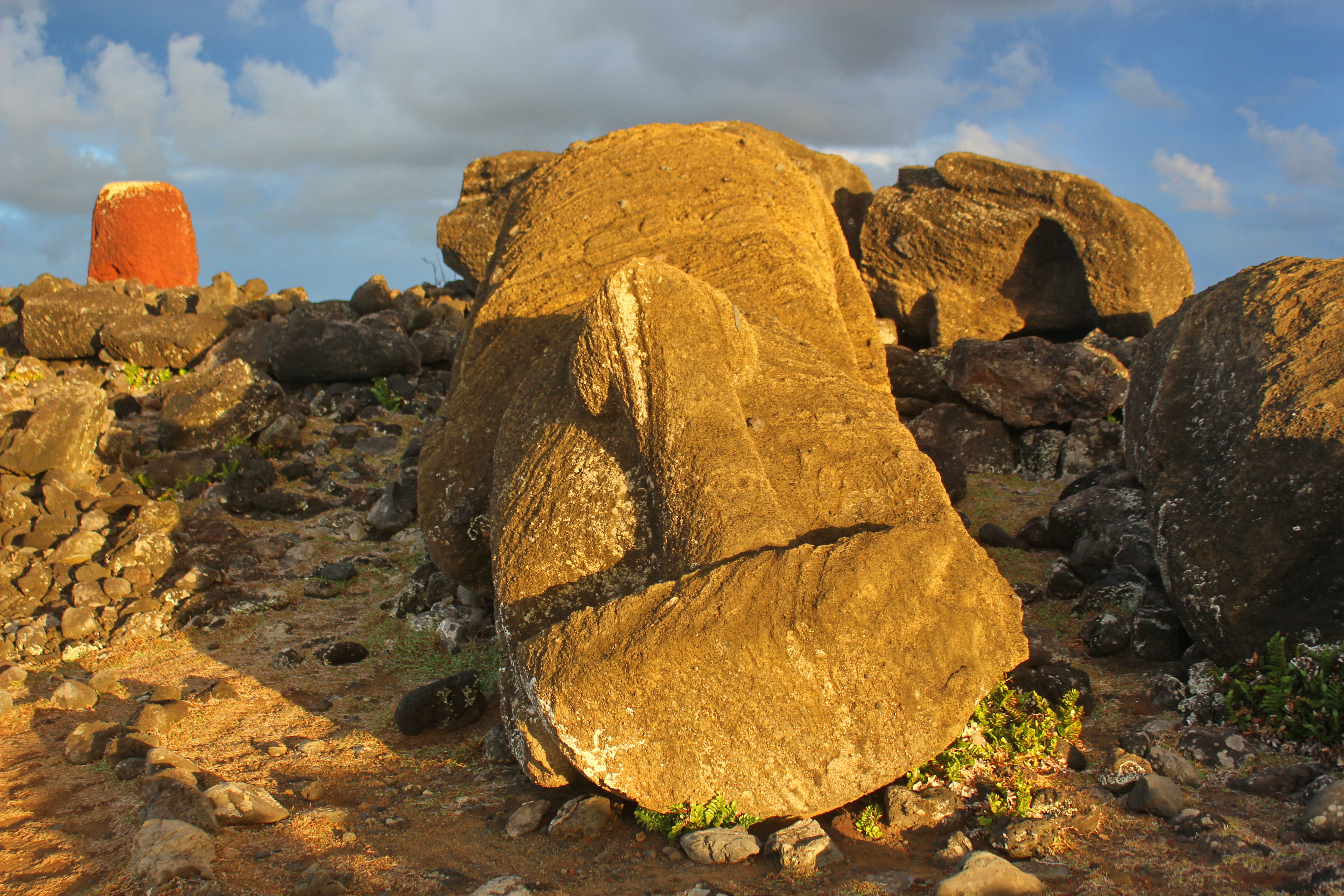
There is much more to the island than the heads—and the “heads” are really statues with full torsos (only the legs are not depicted). More about the statues, properly called moai, and other island wonders in a later post. For now, a couple of notes about the island itself and its situation . . .
Easter Island is so-called because it was “discovered” on Easter Sunday, 5 April 1722, by a Dutch expedition of three ships commanded by Jacob Roggeveen. The Dutch were looking for the legendary Terra Australis which had appeared on maps since antiquity.1
While its small size (a rough triangle of 16, 18, and 22 km; see map below) eliminates it as the fabled lost continent, Easter was (and is) an exceedingly hard to find place without modern navigational aids. Sometimes touted as “the most remote place on Earth,” it is actually the third-most remote-from-other-human-settlements permanently-inhabited island (but just barely).2 Easter Island lies in the South Pacific some 2,112 km (1,312 mi) east of Pitcairn Island (where mutineers of the HMS Bounty settled) and 3,680 km (2,287 mi) west of South America (see map inset).

Easter Island was formed by three volcanoes; in order of appearance: Poike, Rano Kau, and Maunga Terevaka, the last creating the most recent lava flows that bound the three pieces together. There is no coral reef, so the coastline (which ) consists of rocky shores and cliffs all around excepting one sandy beach at Anakena.

Its remoteness, lack of resources, and relatively poor fishing made it a marginal place for human habitation. Yet, when the Dutch and subsequent European explorers arrived, they found a native Polynesian population and impressive constructions. As Easter is the easternmost island of Polynesia, they seem to have arrived by a voyage of discovery and settlement from the west (exactly where is a subject of great debate). Their megalithic monuments, moai, and their apparent downfall impressed European visitors and fueled speculations about various “mysteries” (I’ll get to those in later posts).
About the name . . . Easter Island is obviously a European-imposed designation. What did the natives call it? Ethnological collections do not preserve a prehistoric (before European contact) name. But one was born during one of the most terrible periods in the island’s history. In the 1860s Blackbirders (really just slavers) kidnapped many natives from Easter and other Polynesian islands to work in guano mines and as house servants in Peru. A cheif’s son was taken but then freed on a subsequent stop at the island of Rapa, when natives there seized and liberated the ship. In comparing geographies of their islands, the young future leader realized that his home was a more appropriate Rapa, meaning “extremity,” than Rapa itself and coined the name Rapa Nui, “Greater Extremity” (Rapa is thus sometimes now called Rapa Iti, or “Lesser Extremity”). The name Rapa Nui is used for the island itself today, while the combined form Rapanui designates the indigenous people group and their language.3
The name Rapa Nui was somewhat incomprehensible to a people who spoke a different form of the language and formerly knew of no other landmass, so it was apparently translated into the language of Easter Island as Te Pito ‘o te Henua, the name given to later ethnographers (in the 19th and 20th centuries). The phrase has been translated “The Navel of the World.” It is a poignant expression of the Rapanui perspective in which they could see, from Maunga Terevaka, their island in its entirety and nothing else but ocean to the horizon in every direction.4
But Te Pito ‘o Henua can also be translated “The End of the World.” As it happens, that is an eerie summary of recent interpretations of Rapa Nui’s tragic history, which posit it as a preview and warning to all inhabitants of the World.
Continue to Part 2: Click Here!
Thanks for looking! ![]()


Not as good a trip as Easter island.
LikeLike