
Most of my posts result from a combination of visits I have made to odd places, some latent interest sparked by a random input, and bizarre current events. This is one of those posts. The stimuli, respectively, were a recent visit to the Orkney Islands, my 26 July A.Word.A.Day (AWAD) email featuring ultima Thule, and President Trump’s bid to purchase Greenland.
Despite being a great idea (and not a new one); the latter is NOT going to happen, notwithstanding any confident flaunting of “the art of the deal.” Ultima Thule may require a little explanation—at least to get to the real topic of this post . . .
We begin sometime between 320-300 BC when Pytheas, an explorer from the Greek colony of Massalia (modern Marseilles, France), became the first known Greek to sail past the Carthaginian blockade at the Straits of Gibraltar. His apparent goal was the tin mines of Cornwall, but he also circumnavigated Britain and described its triangular shape accurately. In northern Scotland, Pytheas heard from the locals of a mysterious island called Thule (Θούλη). He reported of Thule that: it was “the most northerly of the Britannic Islands”; “there the circle of the summer tropic is the same as the arctic circle” (Strabo 2.5.8); it lay six days sailing north of Britain (Pliny Natural History 2.186-87); and “there is neither sea nor air, but mixture like sea-lung, in which earth and air are suspended; the sea-lung binds everything together” (Polybius 34.5.3-5).[1] Sea-lung? This got weird. Although the words used are the same as those for jellyfish, Pytheas is using a strange metaphor at minimum.[2] For this and other reasons, many ancient geographers dismissed Pytheas entirely, or accepted his description of Britain and drew the line at Thule.
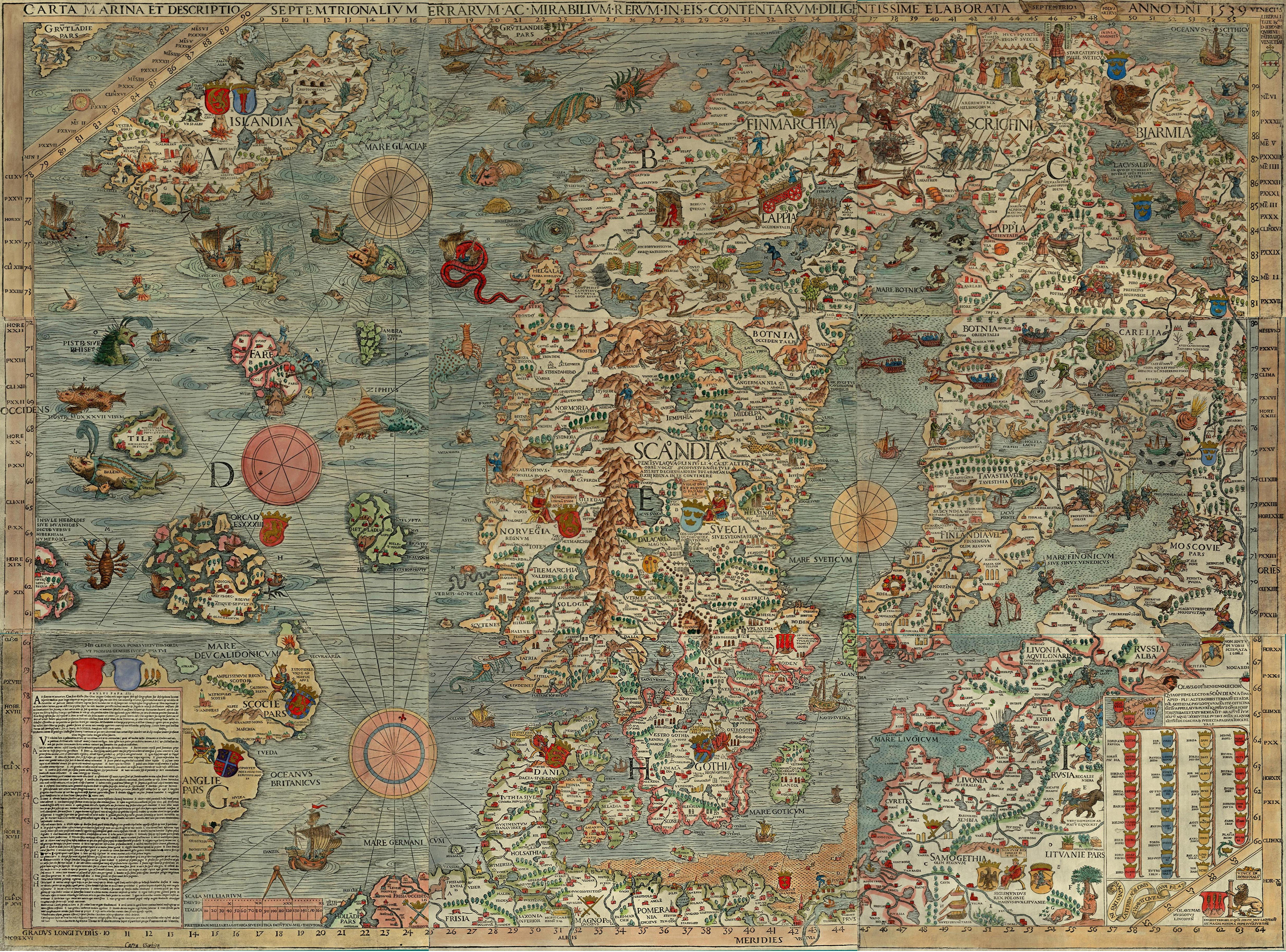
Thule’s actual existence was debated for centuries, its possible real identification even still today, and the name Thule eventually came to mean the most northerly occupied place. The name was attached to Greenland when explorer Knud Rasmussen founded a trading post in the far NW corner of the island and named it “Thule.” The United States Air Force cemented the name by building Thule Air Base nearby in the mid-1950s.[3] Meanwhile, the term ultima Thule developed as a literary extension of the geographic idea, meaning “the farthest place” or “a remotely distant goal.” Thus, the title of this post . . . which, admittedly, does not obviously reveal the pictorial topic.
If Thule was a real place, where was it? Some in the past have identified Thule with the Orkney Islands. That is good enough for me to use this weird thread of logic to feature some pics from the center of Mainland, the central island of the Orkneys.

I rather liked Orkney. Crowds at important places could be minimized, even at the height of the tourist season. This is partly due to the relatively limited accommodations there. One could find huge clots of tourists, but they came for organized day-trips via ferry from the north tip of Scotland. Stuck on bus-tours, they were predictable and easily avoided. The other great secret is something mentioned by Pytheas: “For it was the case that in these parts the nights were very short, in some places two, in others three hours long, so that the sun rose again a short time after it had set” (Geminus, Introduction to the Phenomena 6.9). Indeed, in Orkney in early July, the sun set around 22:30 (10:30 pm) and rose around 04:00. Tourists seem to arrive about 10:30 and depart around 16:00, leaving lots of time to see stuff in the early morning or late afternoon-evening unencumbered.


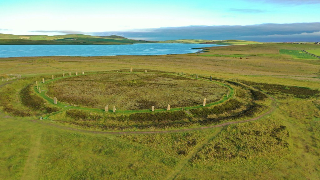
In the heart of Mainland, Orkney lies a fantastic collection of megalithic monuments. The crown jewel is the Ring of Brodgar (built 2500-2000 BC), the largest stone circle (103.6 m/340 ft) in Scotland and the 3rd largest in the British Isles. It is unusual in that the perfect stone circle is combined with a henge, much like Avebury in England. The site is part of a UNESCO World Heritage Site and very much the signature location in Orkney (see the great example at left, which also nicely incorporates the low sun). During the main hours of the day, the Ring of Brodgar is crawling with bus loads of day-trippers, but I did not see another living human between 05:30-07:00!
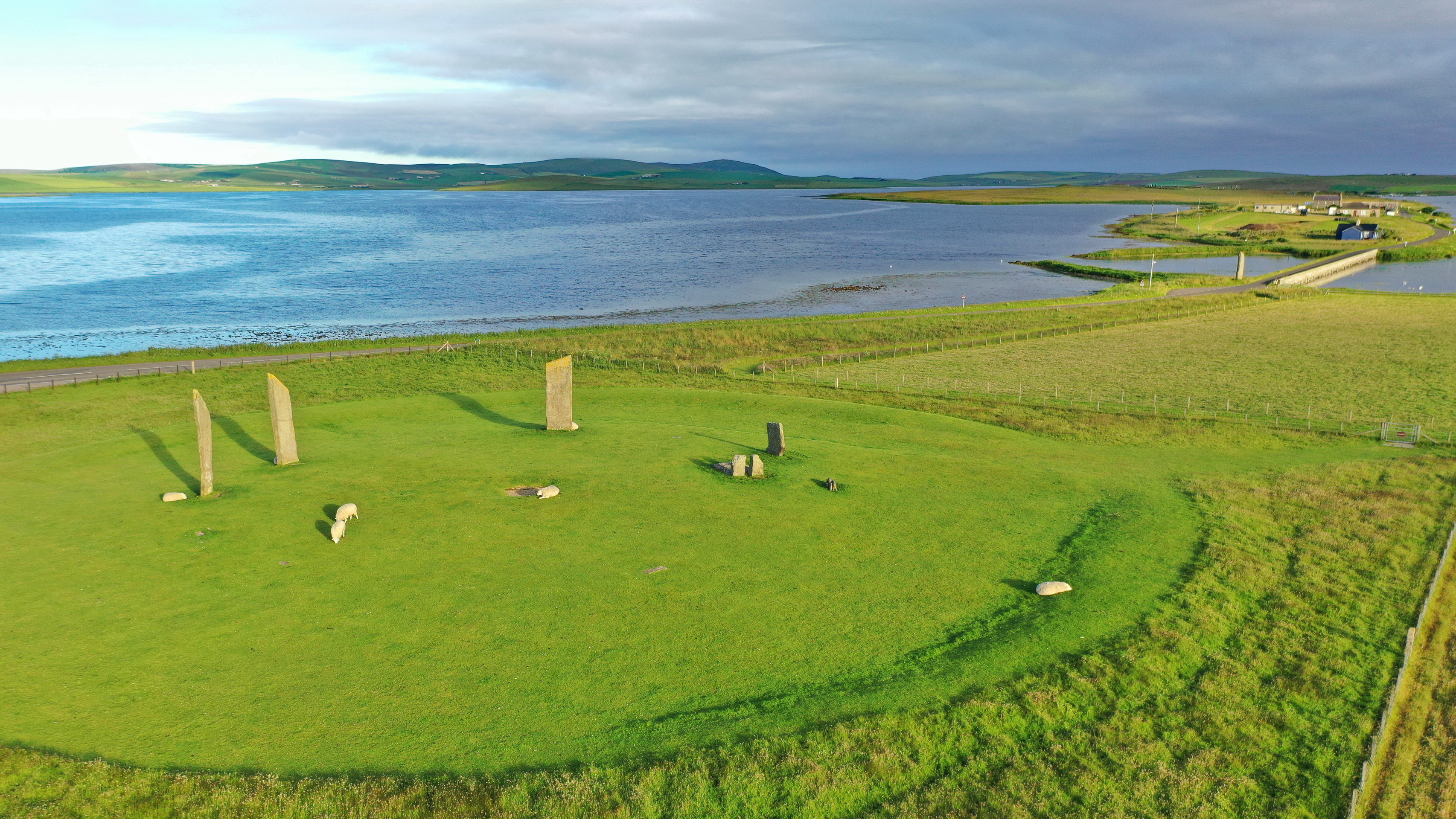
The Ring of Brodgar dominates a narrow peninsula separating the lochs of Stenness and Harray. A mile to the south are the Stones of Stenness, four huge megaliths that remain of an earlier stone circle. The site has an eerie magnificence with its giant standing stones (up to 19 ft high) with sheep dozing or eating at their bases. An outlier monolith called the Watch Stone (also 19 ft) dominates the near end of a bridge on the road that leads to the Ring of Brodgar.
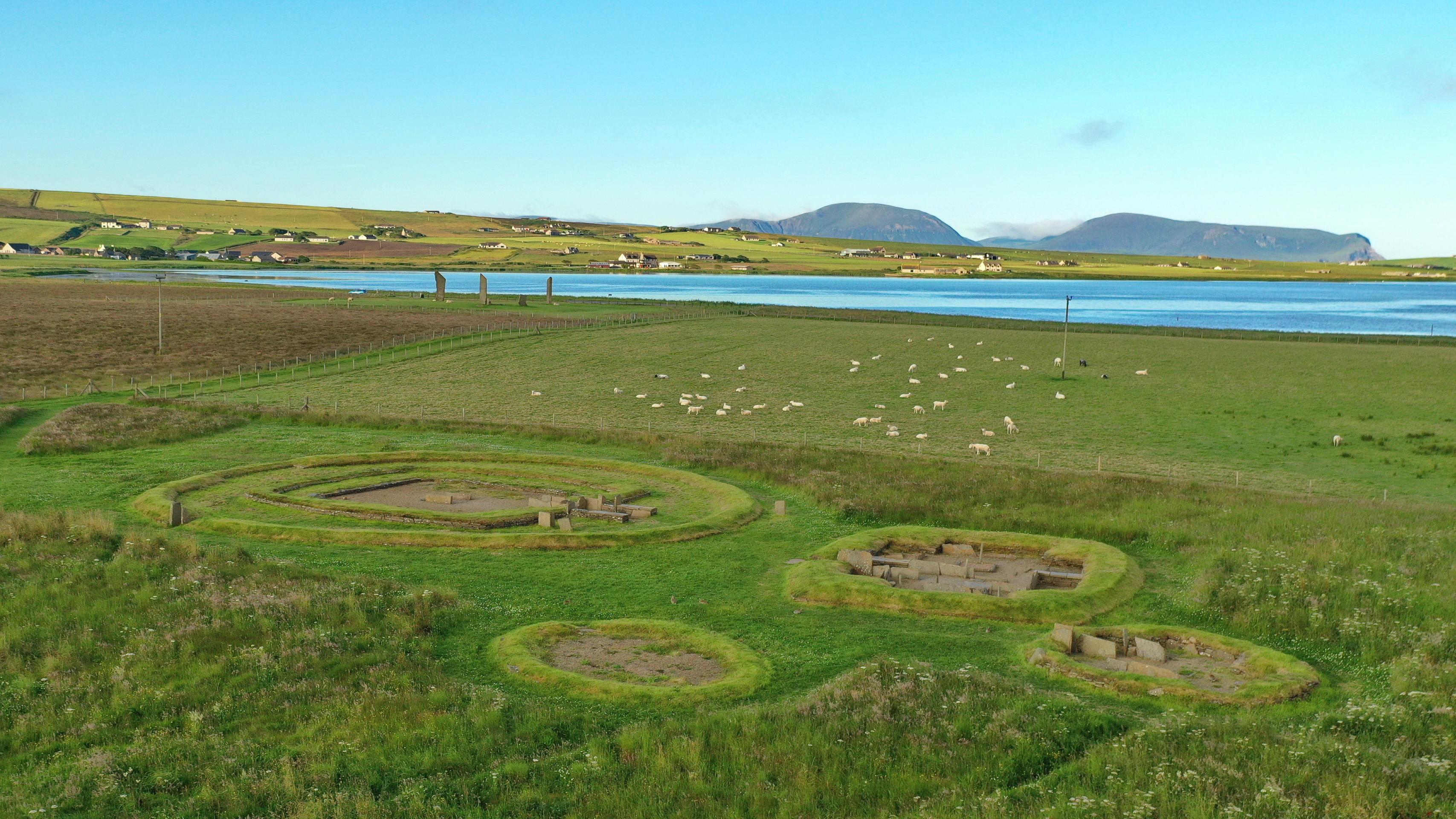
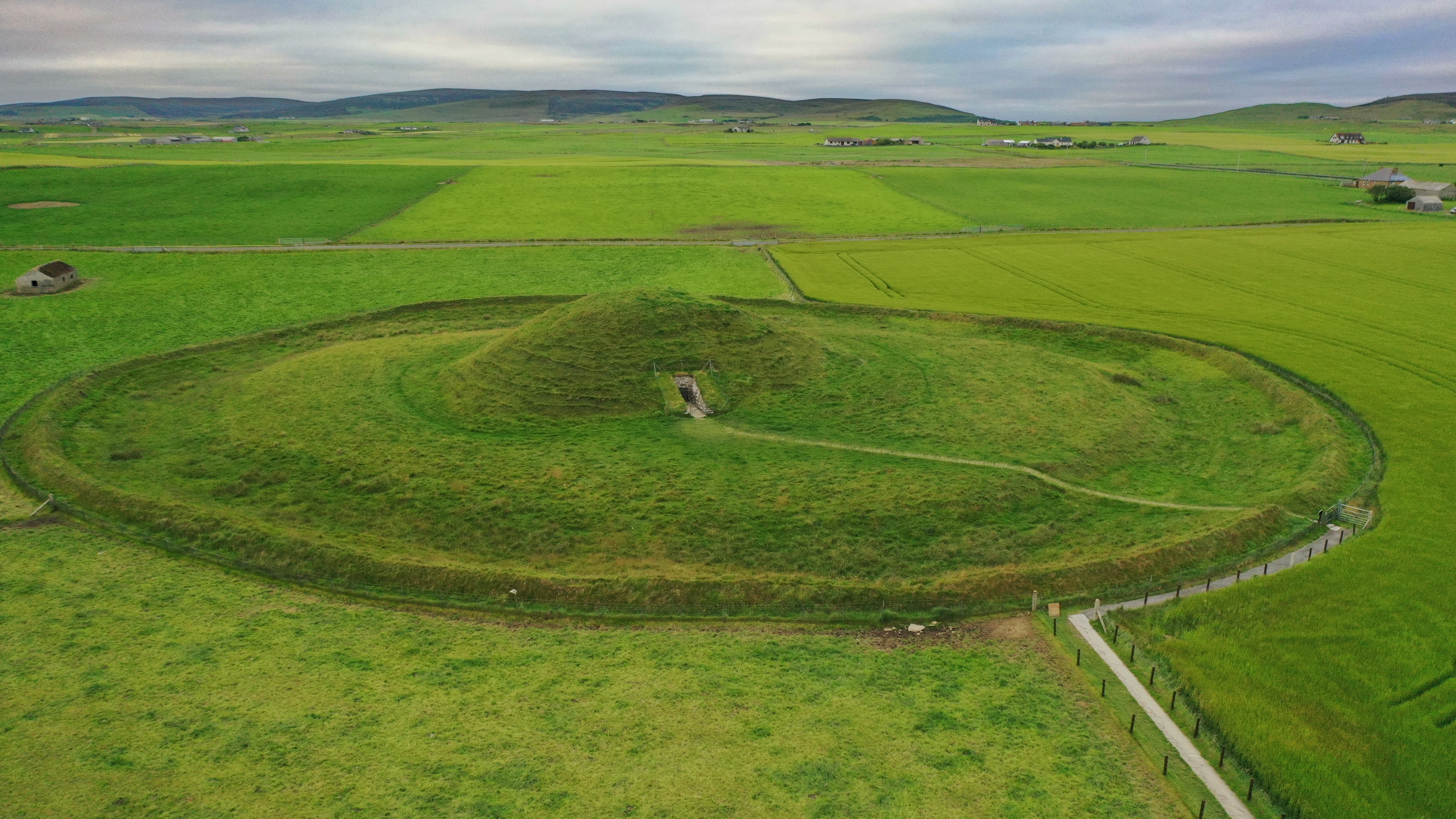
Near the Stones of Stenness are the excavated remains of the contemporary Barnhouse Settlement, a Neolithic village of 15 or so houses, including one (Structure Two) that is larger than the others. Past the Watch Stone and across the bridge are continuing significant excavations of more Neolithic structures, called the Ness of Brodgar, that continued after Barnhouse was abandoned. In that later period, Structure Eight, probably for cultic use, was built by the ruins at Barnhouse. It seems to be oriented—as is another standing stone—with the largest chamber tomb in the region, Maeshowe (and another target of many of those bus tours). These interesting sites are all within a linear mile and a half. There are other significant Neolithic sites and other wonders in the Orkneys, but they will have to wait. Like Greenland.
One more thing: is there any chance Orkney is the Thule of Pytheas? Almost certainly not. Tacitus’ biography of his father-in-law and Roman governor of Britain from 78-84, Julius Agricola, claimed the Roman fleet circumnavigated Britain and, “thus established the fact that Britain was an island. At the same time it discovered and subjugated the Orkney Islands, hitherto unknown. Thule, too, was sighted, but no more; their orders took them no farther” (Tacitus, Agricola 10). This eliminates Orkney as Thule, but brings the Shetland Islands and possibly the Faroe Islands into play. Modern scholarship ignores them and prefers either Iceland or Norway. I should like to travel to all possibilities, but for now this desire is my own ultima Thule.
[1] Astute readers (obviously you, because you are reading the footnotes) may have noticed that I am not quoting Pytheas himself, but rather other classical authors. This is because Pytheas’ writings are lost, save their quotations by others.
[2] “Sea-lung” renders πλεύμονι θαλαττίῳ in Strabo 2.4.1.
[3] My first knowledge of Thule came as a young child when my Dad, a USAF pilot, used “sent to Thule” as a jovial reference to the worst potential disciplinary reassignment during the Cold War.
Thanks for looking! ![]()
