
I do not wish to downplay other tragic locations associated with the term, but “Ground Zero” was originally used only for the surface location closest to the detonation point of a nuclear explosion. Mississippi is home to one of those fortunately rare spots.
Fifty-five years ago (as of today) an atomic bomb was detonated—on 22 October 1964 (and on purpose)—in south Mississippi. It was the first of two nuclear test explosions in the same location, and the only ones east of the Mississippi River. The nuclear test detonations, along with two later gas explosions, were conducted by the U.S. Atomic Energy Commission and the Department of Defense in the Tatum Salt Dome, 21 miles southwest of my home in Hattiesburg, MS.
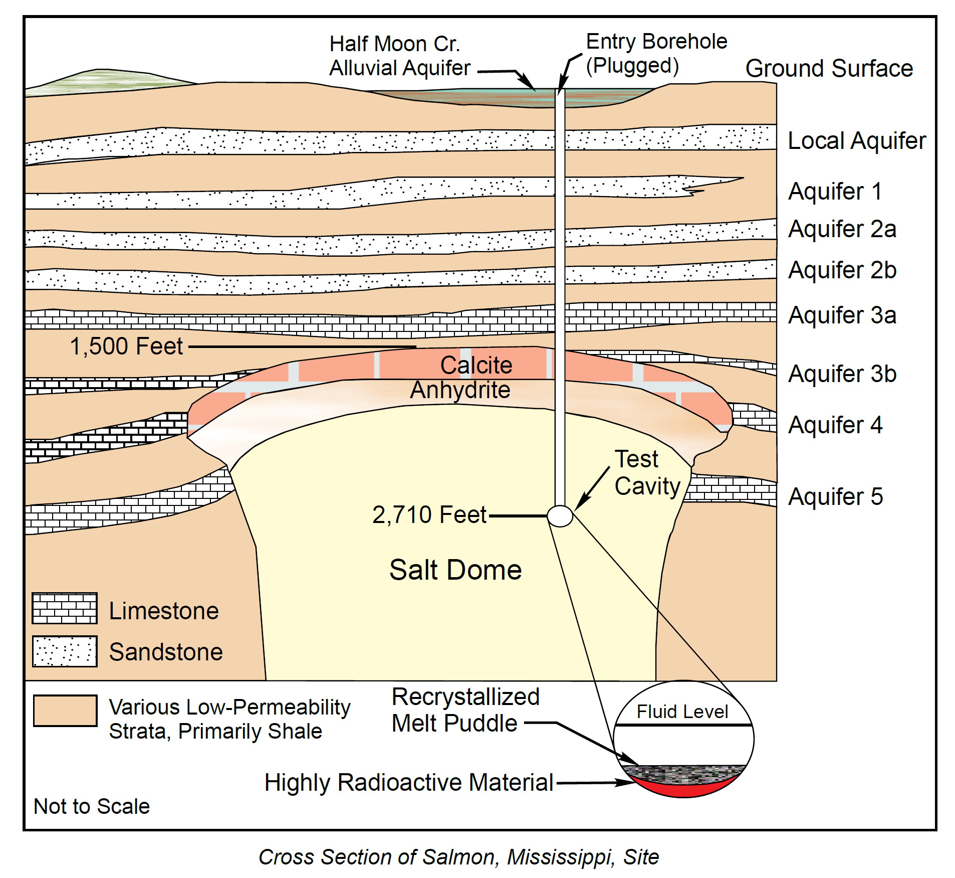
The two nuclear explosions were part of a larger project called the Vela Uniform Program, which was concerned with developing methods of detecting (and perhaps limits for avoiding detection of) underground nuclear tests in light of potential test ban treaties. The Tatum Salt Dome provided a capped chamber some 1500 feet below low-permeable strata; well-suited for certain parts of the program. A shaft was drilled 2,710 feet into the salt dome, where on 22 October 1964, the 5.3 kiloton yield nuclear device code-named “Salmon” was lowered and detonated, creating a chamber in the salt dome (duh). A second nuke, the 380 ton yield device called “Sterling,” was suspended into this chamber and detonated on 3 December 1966. The two nuclear tests were collectively called “Project Dribble.” Two methane and oxygen explosions in the same chamber, “Diode Tube” on 2 February 2 1969 and “Humid Water” on 19 April 1970, were part of “Project Miracle Play.”[1]
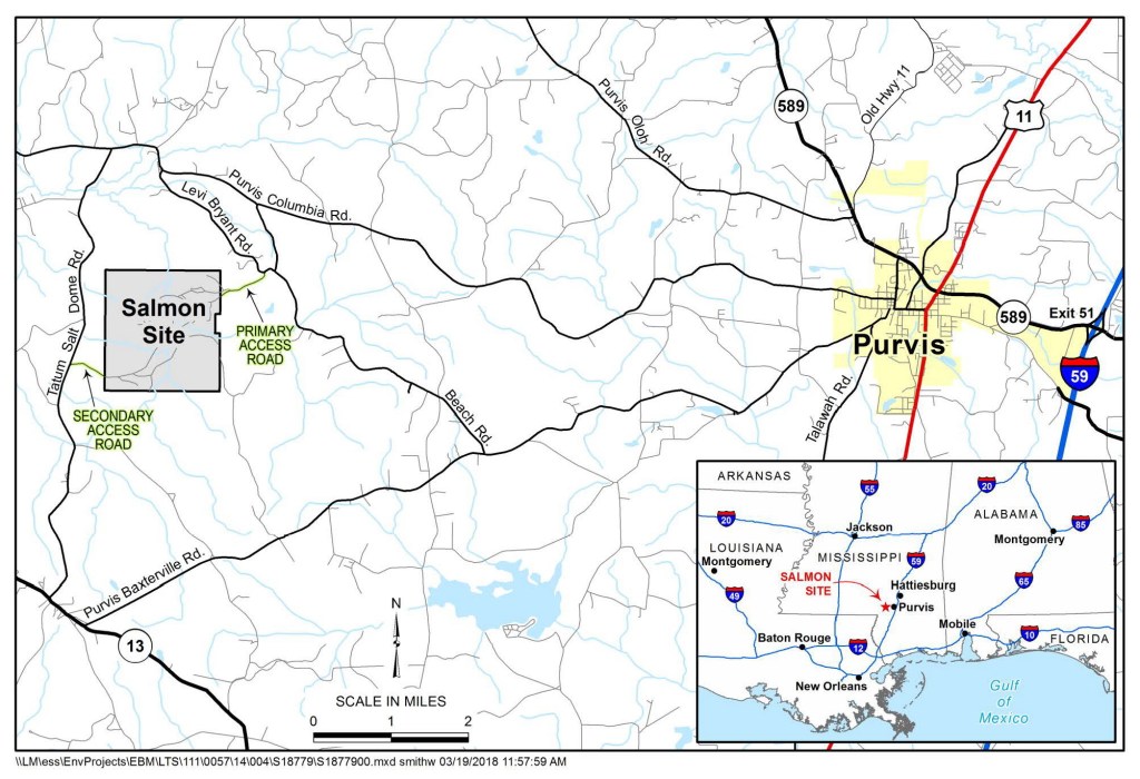
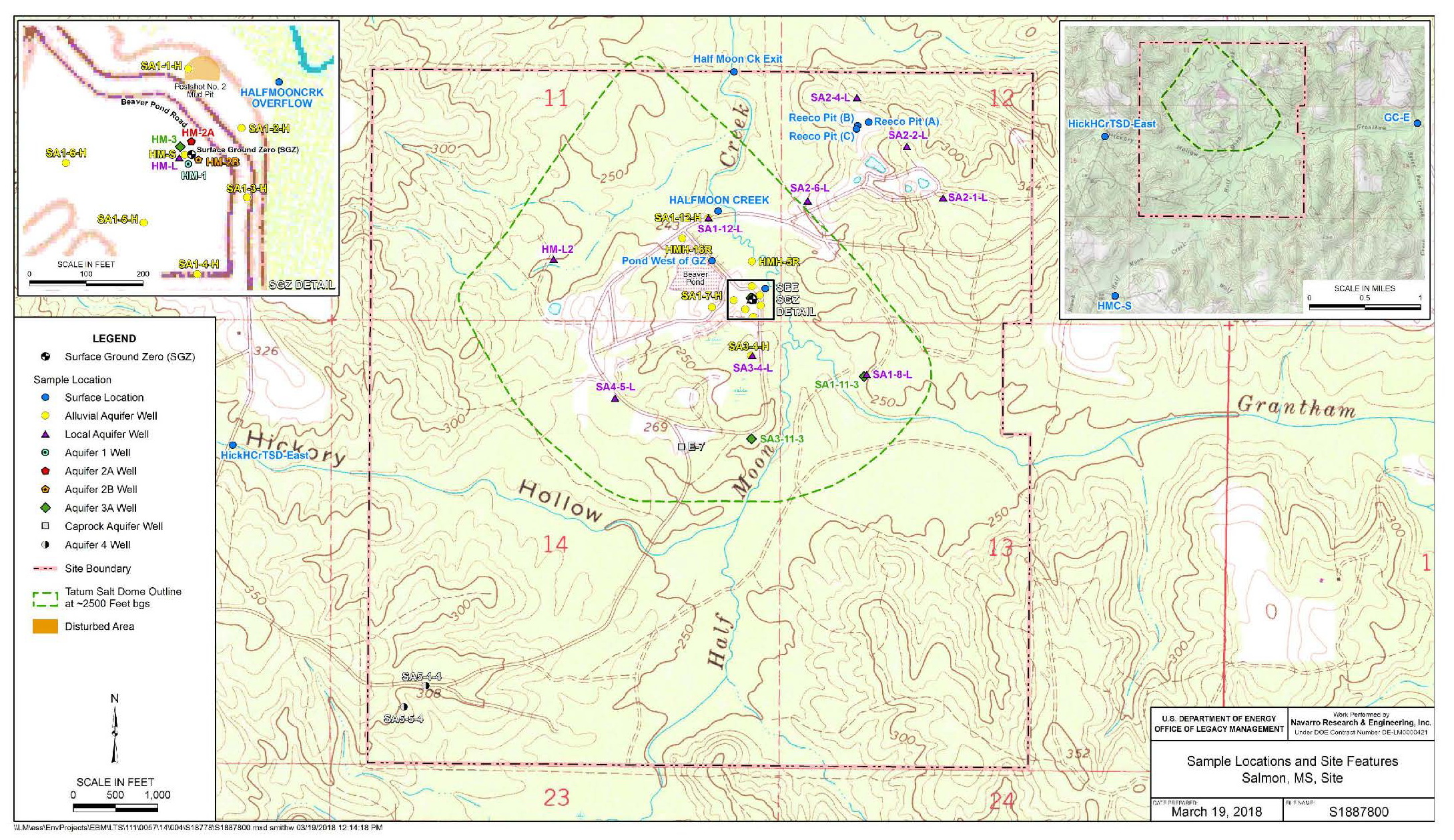
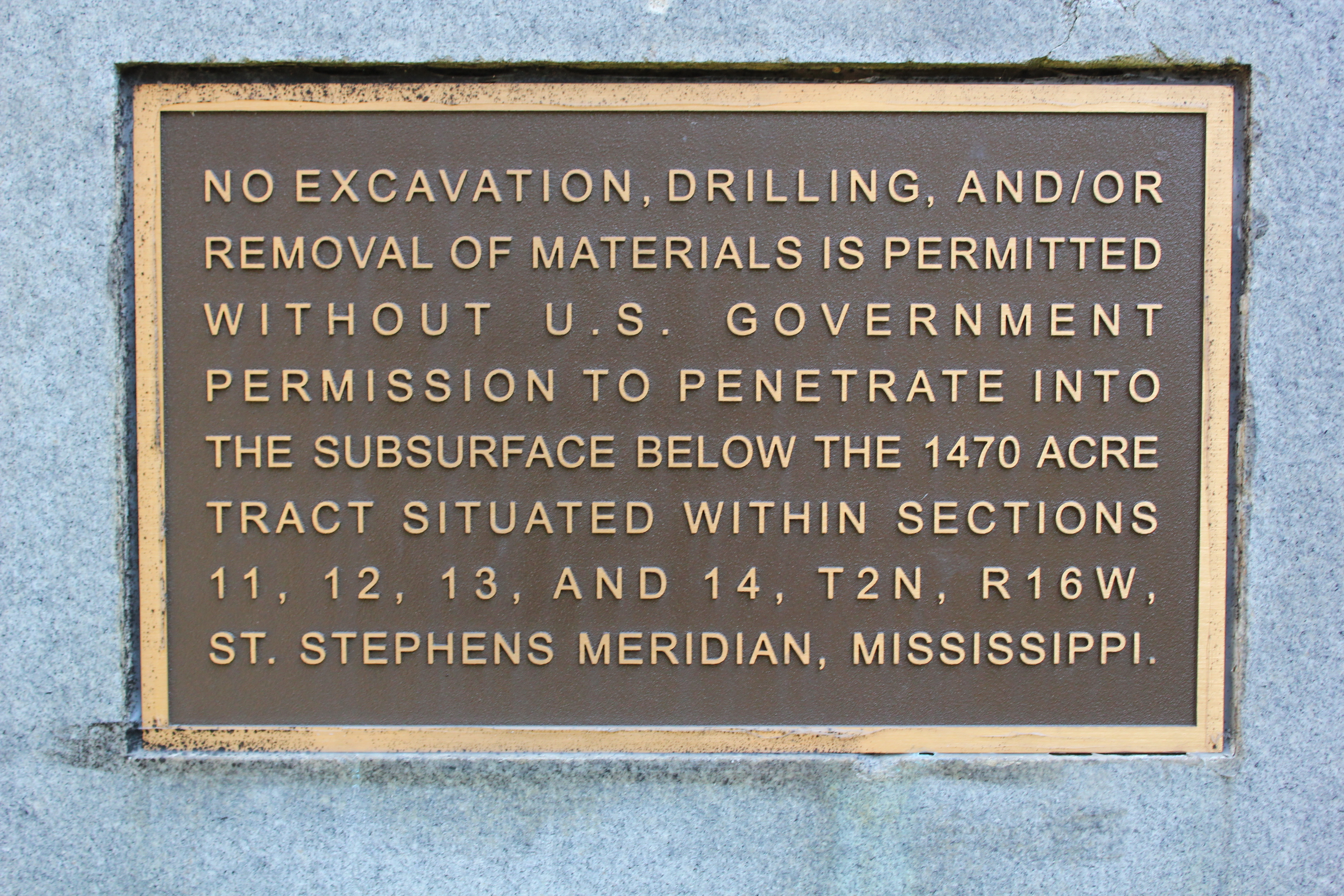
The “Salmon Site,” as the 1,470 acre tract above the Tatum Salt Dome is now known, was sealed, cleaned, and passed from the AEC to the Department of Energy in 1992. The DOE retains the underground rights for the land and continues to monitor it via numerous test wells for radiation.
Surface ownership of the parcel was ceded to the State of Mississippi for use “as a wildlife refuge and working demonstration forest.”[2] Meanwhile, the detonation chamber apparently contains a stratum of highly radioactive material, covered by a recrystallized melt puddle, and fluid, all safely contained by the salt envelope and sealed shafts above.
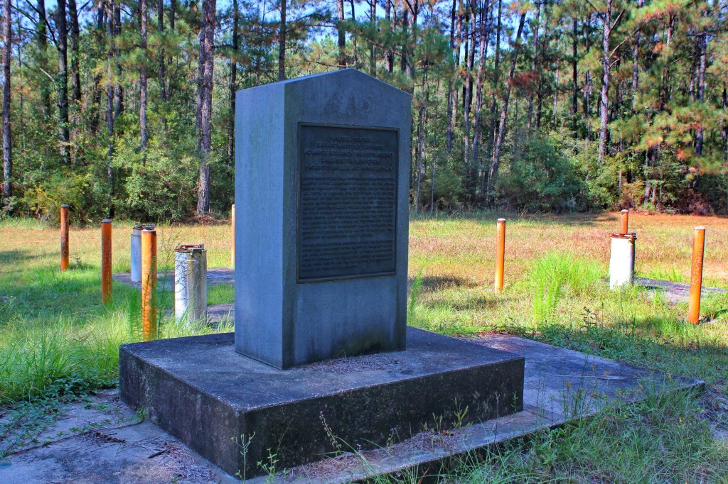
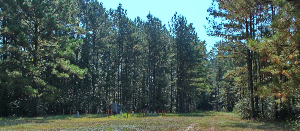
Today a concrete marker with two plaques marks the Surface Ground Zero of Mississippi, 2,710 feet above the detonation point and resulting radioactive chamber. It is a truly awkward monument. For starters, it is not easily visited, as the vehicle access “roads” are unmarked, gated, and locked. When the monument is finally reached, the main informational bronze plaque faces away from any who approach, as if embarrassed to reveal its story.
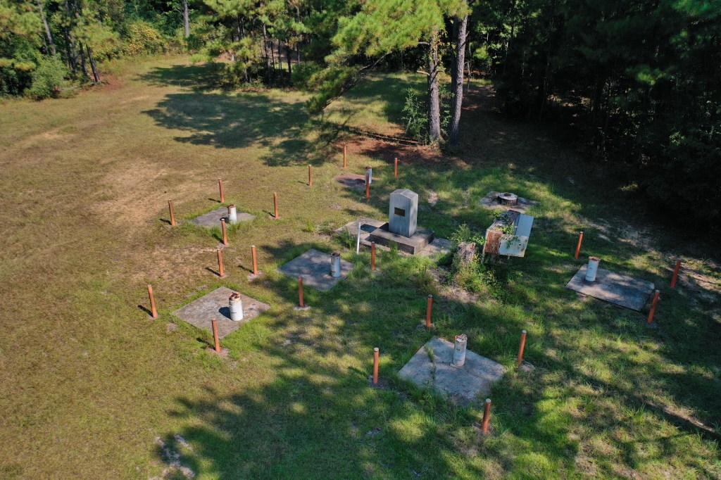
The SGZ monument seems guarded by six closed and securely locked test wells, each in turn protected by concrete-filled security poles. A rusty electrical panel box stands close by (wasps prevented me from testing the outlets in it) next to the stump of a formerly large tree.
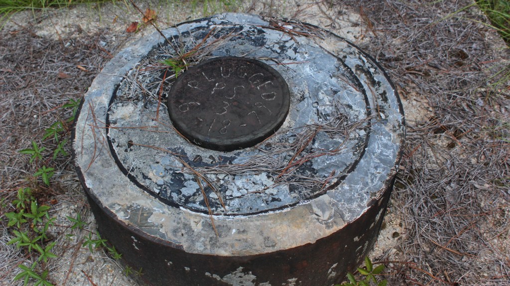
A ominous sealed shaft beyond the monument and panel is unmarked except for the label added to the lid by the talented welder, “PS 3 – PLUGGED 6-18-79.” All this odd setting is put in context by the smaller—and arguably more important—plaque on the concrete monument, facing any arriving visitor and warning them against excavation of any kind. Good idea.
Thanks for looking! ![]()
[1] Government project codenames fascinate me . . . other Vela Uniform underground tests were conducted in Nevada and at one site in Alaska with various codenames, including “Long Shot,” “Diamond Dust,” and “Diamond Mine;” with “Sterling” and “Miracle Play,” it sounds like some kind of casino game or lottery—the latter of which Mississippi is starting next month.
[2] U.S. Department of Energy, Office of Legacy Management, “Fact Sheet: Salmon, Mississippi, Site,” https://www.lm.doe.gov/Salmon/Fact_Sheet_-_Salmon.pdf, Nov, 2018. This and other official documents can be found at https://www.lm.doe.gov/salmon/Documents.aspx.

I read about this site a few years ago while chasing some now-forgotten rabbit on Wikipedia. I, too, was fascinated to learn that I grew up (in Stone Co., MS) so near a nuclear test site. And the fact that the first explosion occurred on my birthday made it even more relevant for me—I turned 11 on Oct. 22, 1964.
LikeLiked by 1 person